|
General Histories
of Coleman County, Texas
Location and General Features of
Coleman County
by Glynn
Mitchell and R. D. Holt
(From A
History of Coleman County and Its People,
1985
edited by Judia and Ralph Terry, and
Vena Bob Gates - used by permission.)
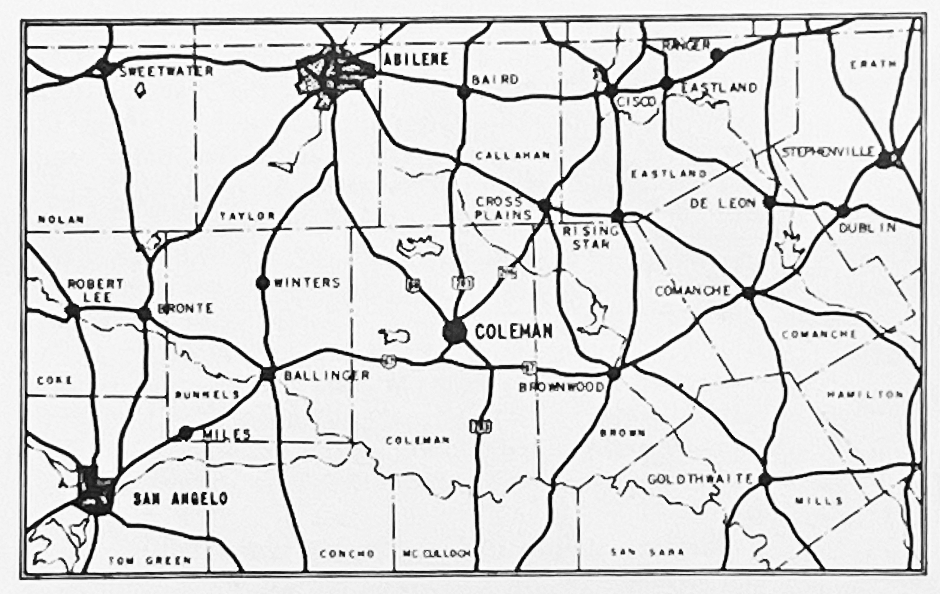
Coleman
County is located in the central part of Texas
with longitude 99°25' west and latitude 31950'
north running through the center of the
county. When first created in 1858, it
contained 1,302 square miles, but through more
accurate surveying, now contains 1,280 square
miles, and extends about 44 miles from north to
south and 29 miles from east to west, with the
Colorado River being the southern boundary.
The highest elevation is in the northwest corner
of the county at 2250 feet. The county lies
in the West Texas Rolling Prairie of the North
Central Plains, which is an extension of the Great
Western Lower Plains, one of the four major
divisions of North America that meet in
Texas. The county has only two distinctive
physiographic areas: the first is gently sloping
uplands; the second is the dramatic mesa-like
mountains scattered throughout the county.
About 60 million years ago the entire county was
covered by geologic materials of the Cretaceous
Age, but now most of it has been removed by
erosion. Only a few remnants remain as
mesa-like mountains which rise above the
surrounding area.
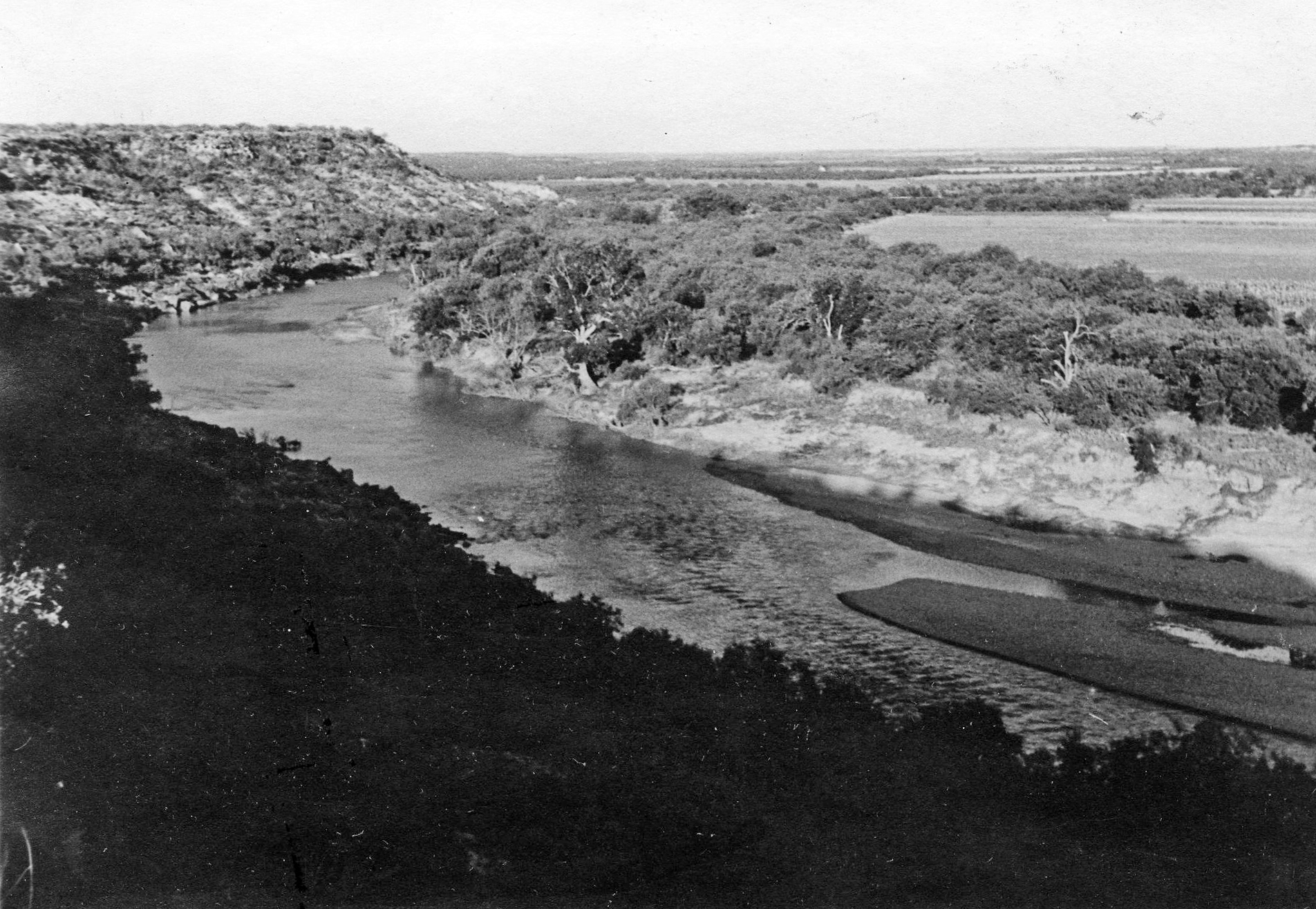
The Colorado
River, southern boundary of Coleman County
Underlying materials of the Permian Age have been
exposed throughout the county. In the
southeastern portion of the county geological
materials of the Pennsylvanian Age have been
exposed. The Cretaceous and Permian
dispositions and wind-deposited materials of the
Recent Age make up the parent materials of the
soils in the county. Coleman County is in
the transitional zone between the humid climate of
east Texas and the semiarid climate of west and
northwest Texas. The average rainfall is
26.82 inches and precipitation is usually greatest
from April through June. The wettest year
was 1935 with 45.28 inches and the driest, 1917
with 12.74 inches. The average date of the
first freeze is November 16 and for the last
freeze is March 26. The prevailing winds are
southerly and on occasion become strong and
persistent from the south or southwest. The
strongest winds are northerly and are associated
with cold front passages.
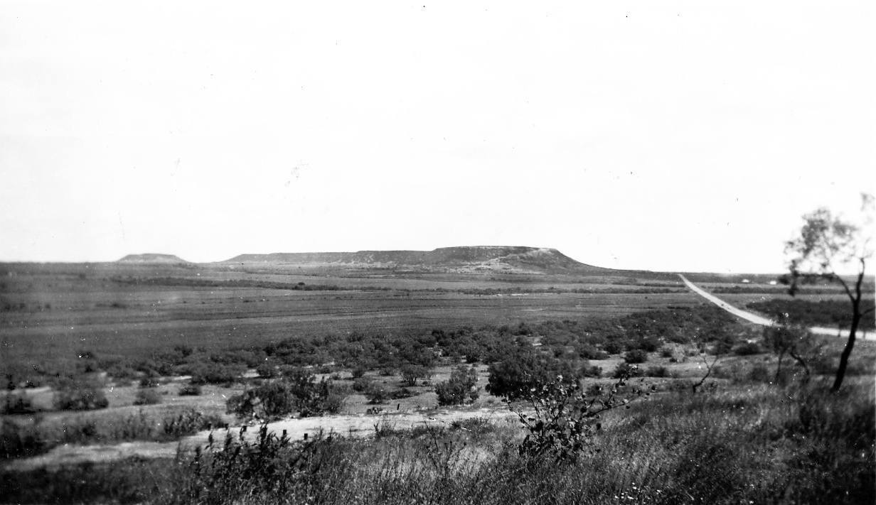
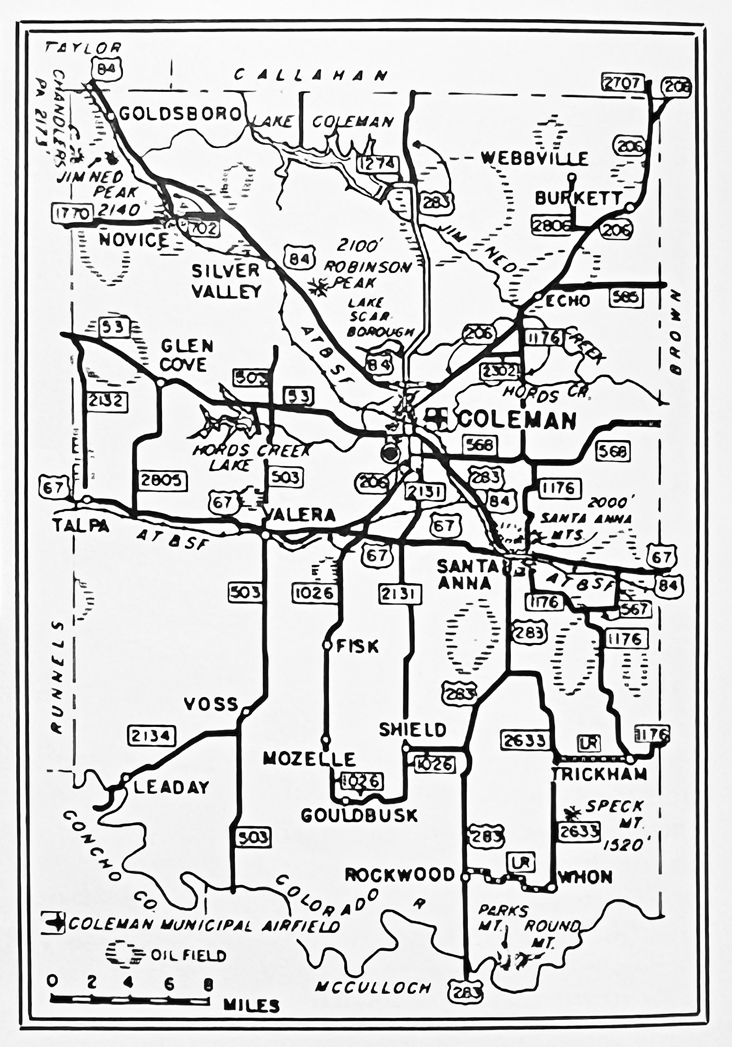
The Santa Anna Mountain
from the north
Topographical landmarks are the Santa Anna
Mountains near Santa Anna, which guided Indians,
trail drivers and early settlers with an elevation
of 2000 feet and Bead Mountain between Valera and
Talpa with an elevation of 2100 feet. The
northern part of the county is drained by the Jim
Ned Creek, which has its source in Taylor County
and empties into Pecan Bayou in Brown County,
while the southern part is drained by the Elm,
Grape, Bull, Wildcat, Home, Hay, Mukewater,
Mustang, and Panther Creeks. Other creeks in
the county are Rough Creek, Cow Creek, Indian
Creek, and Buffalo Branch. The early settler
found little timber anywhere in the area, except
along the streams, were elm, pecan, and cottonwood
trees were scattered. Although mesquite
timber now covers most of the land that is not in
cultivation, the early settlers stated that there
was no underbrush when they first saw the land,
due perhaps to the fact that the Indians had
previously set fire to grass in the fall so as to
insure good grass for the next spring and thus
attract the buffalo to the region. Mesquite
and buffalo grass were the principal grasses in
the area and the first cattlemen found these to be
especially good for cattle. The plant life
now is typical of Central Texas with wild flowers,
shrubs, and cacti found throughout the area.
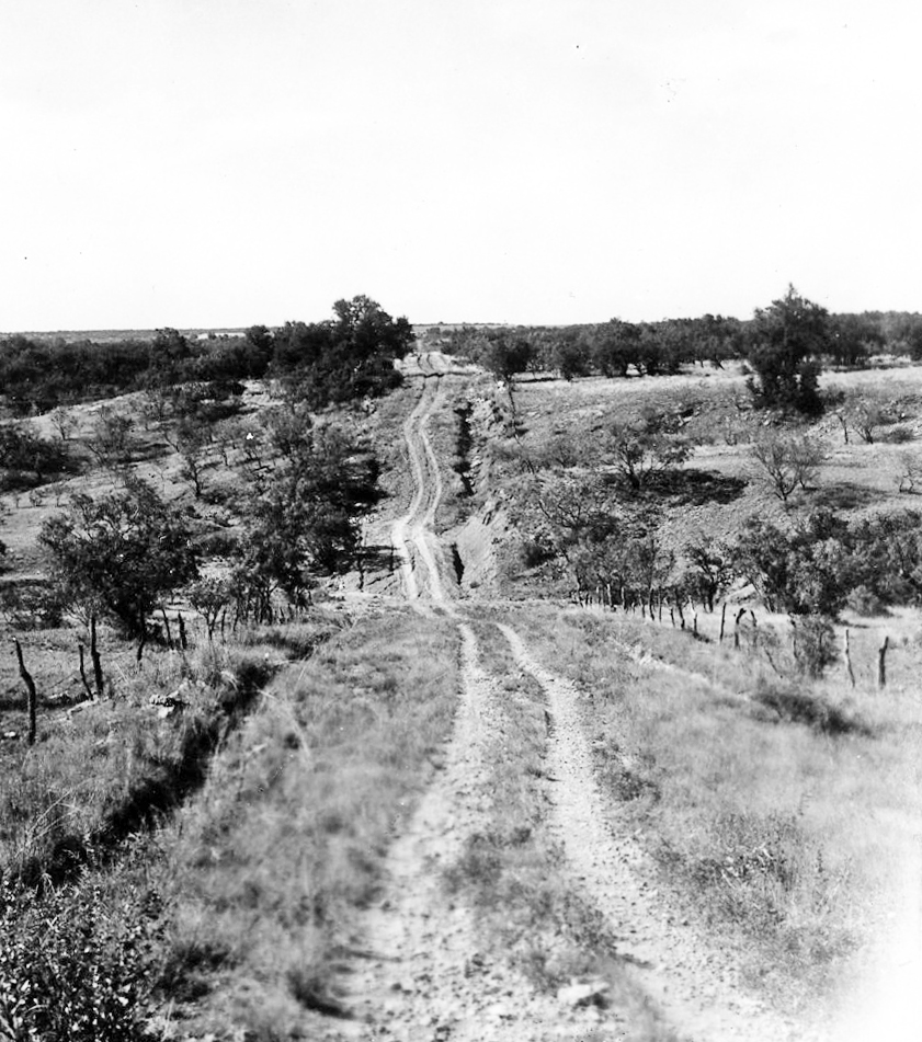
Typical roads of Coleman
County in the 1920's
|
|
It is typical mesquite grass country, but
other types such as buffalo, needle, grama, spear,
and little and big bluestem grasses are found.
Mesquite timber covers most of the land
that is not in cultivation, but such trees as post
oak, live oak, and black jack are found in the
eastern half of the county and scattered over the
hills elsewhere. Pecan trees are found along
the streams. In the early days, the Jim Ned
country was a mere paradise for wild game, such as
buffaloes, deer, bears, antelopes, and turkeys.
Deer and wild turkey are still plentiful
today. O'possums, raccoons, civit and
ring-tailed cats, jack rabbits, and a few coyotes
are found throughout the county, and the armadillo
and the cotton-tail rabbit are common in the
wooded areas. Lakes, streams and surface
tanks are stocked with game fish and afford
considerable sport and food. All varieties
of catfish are found in the Colorado River.
The bobwhites and mourning dove are game birds
found in the area, while songsters such as the
mocking-bird, scissor-tailed fly catcher, wren,
and cardinal are also found. A wide variety
of soils are found within the county with sandy
and sandy clay in the east part; black waxy,
chocolate and gray soils in the central and south;
thin gray in the hill country; and sandy soil in
the northwest.
Coleman County has always been well situated to
the livestock industry. A number of
extensive ranches are found throughout the county,
and stock farming has replaced cotton as the
number one money crop. Cotton production
dropped from a peak of 42,619 bales in 1926 to
300-700 bales in the 1960's. Grain sorghums,
oats, wheat, and hybrid sudan grasses are grown
extensively and some find a profitable market
through livestock. Hereford and Angus, as
well as many cross-bred cattle are found in the
county, and the Rambouillet sheep is the most
popular breed of sheep. The county ranks
near the top in sheep raising counties of the
state. Hog raising is on the increase and
the raising of turkeys and chickens for market as
well as for egg production has become a good
source of income.
The City of Coleman is the banking and commercial
center of the county, while Santa Anna is the
second largest town, being noted for its past
production of glass sand found in the mountain
there, which has been shipped to many states and
foreign countries. Brick and clay tile are
manufactured at Coleman, as well as western
clothing, boots, office supplies, plastic items
(such as hummingbird feeders), and air
conditioning parts. Excellent quality meats
are produced in Coleman and an outstanding
Livestock Auction Commission provides an excellent
market for the region. The oil and gas
industry ranks with ranching as one of the
county's greatest industries.
Production has been widely scattered thereby
benefiting land owners in all sections of the
county. The drilling for oil has brought many
suppliers and associated businesses to the
county. Lake Coleman, some sixteen miles
north of Coleman on the Jim Ned Creek, was
completed on May 10, 1966. It is owned by
the City of Coleman for a municipal water supply,
which is now supplying water to many parts of the
county. Hords Creek Lake and Lake
Scarborough still furnish some of the water to
Coleman. All three lakes serve as recreation
centers to local folks as well as for the
inhabitants of several bordering counties.
Coleman County's earliest citizens were confronted
with problems typical of frontier counties of west
Texas. The county has developed into
prosperous and peaceful communities with schools,
churches, farms and ranches, which represented
toil, sacrifice, and the devotion of pioneer men
and women.
|