
History of Lynn County Texas
 LYNN
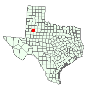
COUNTY. Lynn County (G8) is on the High Plains of Texas in the southern
part of the South Plains. The county lies just to the west of the Caprock;
a small part is below this escarpment. The elevation ranges from 2,881 to
3,274 feet above sea level. Tahoka, the county seat, is thirty miles south
of Lubbock and very near the center point of the county, which is at 33°10'
north latitude and 101°50' west longitude. Lynn County embraces 915
square miles of almost level terrain dotted with an occasional draw or playa.
Two yearround lakes exist in the county: Double Lakes, seven miles northwest
of Tahoka, and Tahoka Lake, five miles northeast of Tahoka. Mound Lake is
a large and permanent playa on the LynnTerry county line, and Twin Lakes
and Guthrie Lake are also large playas found in the southwestern quarter
of the county. The sandy loam, black, and gray soils of the county support
both largescale cotton farming and the ranching industry. Rich prairie
grasses are native to the area. Mesquite is a pervasive pest on ranchlands,
despite ongoing attempts to eradicate it. The elevation in Lynn County ranges
from 2,650 feet to 3,300 feet above sea level. The annual precipitation
averages 17.88 inches. Temperatures range from an average of 27° F in January
to an average high of 94° in July. The average growing season is 217 days
long.
LYNN
COUNTY. Lynn County (G8) is on the High Plains of Texas in the southern
part of the South Plains. The county lies just to the west of the Caprock;
a small part is below this escarpment. The elevation ranges from 2,881 to
3,274 feet above sea level. Tahoka, the county seat, is thirty miles south
of Lubbock and very near the center point of the county, which is at 33°10'
north latitude and 101°50' west longitude. Lynn County embraces 915
square miles of almost level terrain dotted with an occasional draw or playa.
Two yearround lakes exist in the county: Double Lakes, seven miles northwest
of Tahoka, and Tahoka Lake, five miles northeast of Tahoka. Mound Lake is
a large and permanent playa on the LynnTerry county line, and Twin Lakes
and Guthrie Lake are also large playas found in the southwestern quarter
of the county. The sandy loam, black, and gray soils of the county support
both largescale cotton farming and the ranching industry. Rich prairie
grasses are native to the area. Mesquite is a pervasive pest on ranchlands,
despite ongoing attempts to eradicate it. The elevation in Lynn County ranges
from 2,650 feet to 3,300 feet above sea level. The annual precipitation
averages 17.88 inches. Temperatures range from an average of 27° F in January
to an average high of 94° in July. The average growing season is 217 days
long.
Lynn County was initially occupied by Plains Apaches, who were replaced by a more modern Apachean people around A.D. 1400-1500. During the eighteenth century the warlike Comanches pushed into the PanhandlePlains region of Texas and ousted the Apaches. The Comanches ruled the region until they were defeated by the United States Army during the Red River War of 1873-74 and subsequently withdrawn from the plains. Small skirmishes occurred in Lynn County during the Indian Wars. Col. Ranald S. Mackenzie's Fourth United States Cavalry visited Tahoka Lake in 1872, and in November 1874 attacked a small encampment of Indians near Double Lakes and another at Tahoka Lake. In July, October, and November 1875, units of Col. William R. Shafter'sqv Tenth United States Cavalry, the black "buffalo soldiers," scoured the South Plains. Indian raids on buffalo hunters during early 1877 led to another military expedition in the South Plains. Capt. Nicholas Nolan's Company A of the Tenth Cavalry left Fort Concho in July 1877 and proceeded to Double Lakes in Lynn County. They chased a band of Comanches northwest into New Mexico, lost the trail, and returned to Double Lakes in Lynn County. After eightysix hours with no replenishment of their water supply, Nolan's company, long afterward called the "Lost Nigger" expedition, straggled back to Double Lakes. This was the last appearance by the United States Cavalry in pursuit of Indians in Lynn County. The county was thus opened for settlement after 1877.
Between 1877 and the early 1880s buffalo hunters swarmed across Lynn County and the South Plains to exterminate the last great herds of buffalo. In the early 1880s ranchers began to appear in the county. Initially, only a miniscule economy developed. In 1880 the census taker found Ed Ryan and the A. C. McDonald family raising sheep at Tahoka Lake, while John Porter ran a one-man ranching operation at Double Lakes. The situation changed as large-scale ranching spread into the county. In 1880 the Curry Comb Ranch of the Llano Cattle Company was established in Garza County and spilled over into northeastern Lynn County. In 1882 the Square and Compass Ranch was formed in Garza County and protruded into eastern and southeastern Lynn County. The county's only surviving ranch, the TBar, was established in the central part of the county, around Double Lakes, in 1884. Other ranches appeared in the county after 1884, the only major one being C. C. Slaughter's Tahoka Lake Ranch, established in 1897.
The county remained sparsely settled ranching territory for two decades after 1880. It had no towns; the population was nine in 1880, twentyfour in 1890, and seventeen in 1900. However, after 1900 the situation began to change. Farmers began to encroach on the ranchers' domain, especially after land appropriations for education were carried out. By 1903 enough people lived in Lynn County to call for its formal political organization. The county had been formed in 1876 and named for Alamo defender George Washington Lynn (or Linn), but it remained unorganized until 1903. In that year a majority of its residents forced organization on the outnumbered ranchers. In an election held on April 7 the county was organized, with the new town of Tahoka as the county seat. Subsequently, Lynn County began to grow steadily as farmers pushed ranchers off most of the land. Between 1900 and 1910 the number of farms in the county grew from five to 201 and the number of improved acres from 246 to 20,108. Initially corn and grains were the leading crops, but by 1910 cotton emerged as the premier farm product. By 1920, 23,085 acres was devoted to cotton production; the crop that year was 9,969 bales. In 1930 the acres had increased to 204,005, and production had risen to 27,179 bales.
As this cotton-growing industry emerged, the county prospered and grew; the population increased from 17 in 1900 to 1,713 in 1910, 4,751 in 1920, and 12,372 in 1930. Numerous new towns were founded during the early years of the twentieth century. O'Donnell was established in 1910 as a speculative venture based on the opening up of new farmlands in southern Lynn and northern Dawson counties. Wilson, thirteen miles northeast of Tahoka, was established in 1912 to attract farmers to the newly opened lands of the Dixie Ranch. A large number of Central Texas Germans purchased county lands, thus beginning a small-scale migration of Germans into the county that lasted into the 1950s. Other small communities had evolved around rural schools and cotton gins, but most of them faded away by that time. An exception, New Home, in the northern part of the county, grew into a small but stable town by the 1960s.
As Lynn County's cotton and cattle economy developed, a transportation network emerged. In 1909-10 the Santa Fe extended a branch line from Lubbock to Tahoka and Lamesa via Slaton. This line gave rise to the new town of O'Donnell, and Wilson was established on the line in 1912. Crude, graded, dirt roads were built to encourage wagon and automotive traffic. Roads were extended outward from Tahoka in all four directions; north to the Lubbock County line, east to the Garza County line, west to the Terry County line, and south to O'Donnell, on the Dawson County line. By 1938 the county had fortyfive miles of paved roads: fifteen miles north to the Lubbock County line, fifteen miles west to the Terry County line, and fifteen miles south to O'Donnell. Ultimately, Lynn County developed a comprehensive network of highways and farmtomarket roads, with two major routes, U.S. highways 87 and 380, intersecting at Tahoka.
The prosperity of 1910 to 1929 was founded largely on cotton culture. But falling prices, droughts, and boll weevil infestations combined to drive down production and forced many farmers to leave the area. The number of farms, which reached a peak of 2,138 in 1930, fell markedly over the next decade, to 1,471 in 1940. Hardest hit were the county's tenant farmers, who in 1930 had worked more than half of all the farms in the county (1,448 of 2,138).
After World War II the farming economy became more diversified. Although cotton continued to be produced in significant amounts, wheat and sorghum were also raised; in addition, cattle, sheep, hogs, and poultry, chiefly chickens and turkeys, were produced. During this era of growth and development farming evolved into a highly mechanized business, and towns full of farmers replaced the rural family farmer.
A new element was added to the Lynn County economy after 1950. Oil discoveries in the far eastern part of the county led to modest production. The Arab oil embargo of 1973-74 led to further exploration and smallscale production in the central part of the county, which in 1982 produced 386,642 barrels of crude worth $9,828,159; by 1983 the total production was 10,612,550 barrels. Production increased to just over 800,000 barrels annually by the mid-1980s, although prices had declined.
Politically, Lynn County has been more Democratic than Republican. In presidential elections between 1952 and 1992 the county voted Democratic six of eleven times; Democrats won twelve of thirteen gubernatorial races and twelve of fifteen senatorial ones. In the mid-1980s Lynn County was one of sixtytwo Texas counties still legally dry. By the 1990s the county had established a stable economy revolving around cotton production, supplemented by cattle and oil. Roughly 320,000 acres (55 percent) of the land area is used to grow cotton, which produces 90 percent of the agricultural income. The remaining 10 percent comes from cattle, hog, sorghum, wheat, and sunflower production. Irrigated land totals about 50,000 acres, but by the early 1980s some irrigated farms were running out of water. In the mid-1980s, Lynn County had three banks with deposits of more than $78 million. The bleak days of the Great Depression dropped the population to 11,931 in 1940; then the mechanization and consolidation of agriculture led to further drops, to 11,030 in 1950, 10,914 in 1960, and 9,107 in 1970. Afterward, the population continued its steady decline. In 1980 the census reported 8,605 residents, and by 1990 the population had fallen to 6,758, with the majority residing in towns. Tahoka accounted for 2,868 residents, while O'Donnell numbered 968 in Lynn County (and the rest in Dawson County), Wilson 558, and New Home 175. Most of the remainder of the population lived on farms and ranches. Local attractions include the Pioneer Museum in Tahoka and the Dan Blocker Museum in O'Donnell.
BIBLIOGRAPHY: Donald R. Abbe, The History of Lynn County
(M.A. thesis, Texas Tech University, 1974). Donald R. Abbe, "The History
of Lynn County," Panhandle-Plains Historical Review 60 (1987).
Donald R. Abbe